With a hiatus of over a year since the last post here (although, perhaps paradoxically, this blog saw its highest ever level of interest last month), the anti-paddling brigade might have imagined that this was one source of contention that had been silenced.

However, the River Itchen Navigation was back in the news this morning, with Keith Day of River Access For All (RAFA) quoted in a BBC News article where he says
"Access agreements just don't work.
First you have to trace all riparian owners. Then if just one objects there can be no agreement.
We can't even get a voluntary access agreement on the Itchen Navigation in Hampshire where there is a statutory public right of navigation. The angling interests just refuse to discuss it.
We need a new approach.
First we need recognition that there is already a public right of navigation on all rivers.
Only then can we have balanced discussions on how all river users can share our rivers with due regard to the protection of the environment."
Elsewhere in the region, even sections of tidal waterway, for which there is no dispute about the legal right of navigation, have seen attempts to restrict canoeing and kayaking. On the section of the Hampshire Avon where the tide flows up and under the A35 road bridge, the Royalty Fishery (leased by Southern Fisheries) has long seen misplaced and misleading signs erected - see the River Avon blog for images and the full story.
.bmp) The Hampshire Avon is tidal up to the point marked NTL (Normal Tidal Limit) yet signs are placed downstream (in the location marked by an orange circle) in an attempt to dissuade paddlers from exercising their legal rights. The Avon is also able to be navigated downstream from Salisbury under the extant 1664 Navigation Act. [Crown Copyright. Image produced from Ordnance Survey's Get-a-map service. Image reproduced with permission of Ordnance Survey and Ordnance Survey of Northern Ireland.].
The Hampshire Avon is tidal up to the point marked NTL (Normal Tidal Limit) yet signs are placed downstream (in the location marked by an orange circle) in an attempt to dissuade paddlers from exercising their legal rights. The Avon is also able to be navigated downstream from Salisbury under the extant 1664 Navigation Act. [Crown Copyright. Image produced from Ordnance Survey's Get-a-map service. Image reproduced with permission of Ordnance Survey and Ordnance Survey of Northern Ireland.].
Lying between the Hampshire Avon and the Itchen is the River Test. It has recently been reported that an individual claiming to be a local landowner has attempted to prevent the exercise of public navigation rights on tidal waters - click here for the full account, which appear to range from fairly cordial disagreement to contemptuous use of foul language being directed at an individual kayaker.
Should you be thinking of paddling on the tidal waters of the River Test the following images might be of use.
 Point #1 at the footbridge at SU 367 149 does not mark the normal eastern arm tidal limit and an indisputable (if not uncontested) right to paddle. [Crown Copyright. Image produced from Ordnance Survey's Get-a-map service. Image reproduced with permission of Ordnance Survey and Ordnance Survey of Northern Ireland.]


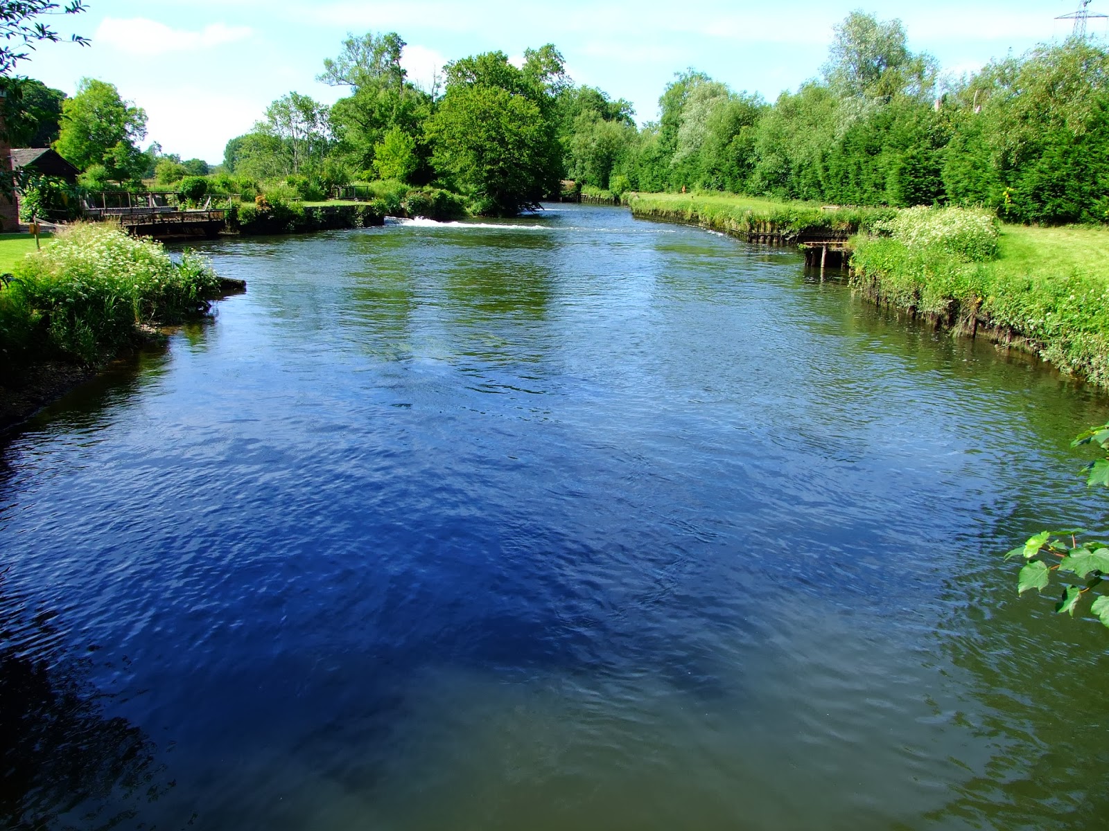
The Itchen Navigation between Brambridge and Bishopstoke. No room to share?
However, the River Itchen Navigation was back in the news this morning, with Keith Day of River Access For All (RAFA) quoted in a BBC News article where he says
"Access agreements just don't work.
First you have to trace all riparian owners. Then if just one objects there can be no agreement.
We can't even get a voluntary access agreement on the Itchen Navigation in Hampshire where there is a statutory public right of navigation. The angling interests just refuse to discuss it.
We need a new approach.
First we need recognition that there is already a public right of navigation on all rivers.
Only then can we have balanced discussions on how all river users can share our rivers with due regard to the protection of the environment."
Elsewhere in the region, even sections of tidal waterway, for which there is no dispute about the legal right of navigation, have seen attempts to restrict canoeing and kayaking. On the section of the Hampshire Avon where the tide flows up and under the A35 road bridge, the Royalty Fishery (leased by Southern Fisheries) has long seen misplaced and misleading signs erected - see the River Avon blog for images and the full story.
.bmp)
Details of high water times at Christchurch Quay can be viewed using the free Easytide service - click here for the latest predictions.
Lying between the Hampshire Avon and the Itchen is the River Test. It has recently been reported that an individual claiming to be a local landowner has attempted to prevent the exercise of public navigation rights on tidal waters - click here for the full account, which appear to range from fairly cordial disagreement to contemptuous use of foul language being directed at an individual kayaker.
Should you be thinking of paddling on the tidal waters of the River Test the following images might be of use.


Downstream of the bridge at SU 367 147 and...

...upstream of the bridge are both tidally navigable (given the right timing for sufficient
depth).

Point #2 at SU 361 144 effectively marks the bar to any further upstream progress on tidal waters on the wetern arm of the lower River Test. However, the bridge at point #3 (SU 362 142) does not. [Crown Copyright. Image produced from Ordnance Survey's Get-a-map service. Image reproduced with permission of Ordnance Survey and Ordnance Survey of Northern Ireland.]

The drop below the bridge at SU 361 144...
...would normally prevent passage upstream, but even if you could do so, the issue of portaging around further upstream obstructions marks the River Test as one of the most contentious of potential inland paddles in the country.

However, paddling below...

...and above the bridge at SU 362 142 may not be legitimately challenged on anything other than sufficient depth of water to float a boat.
Details of high water times at Redbridge can be viewed using the free Easytide service - click here for the latest predictions.
